
Route description
Public area of Cala Mitjana and surroundings
The route runs through a huge public space. This space was created in 2000 when the Ministry of the Environment bought the forest belonging to the Santa Ponça estate and the Es Calafat estate from the Olives family – prominent Menorcan landowners.
This public property is pierced by the section of Camí de Cavalls (Cala Galdana – Binigaus), which in this area is far from the coast, and also by the coastal path that runs closest to the sea.
Horse riding
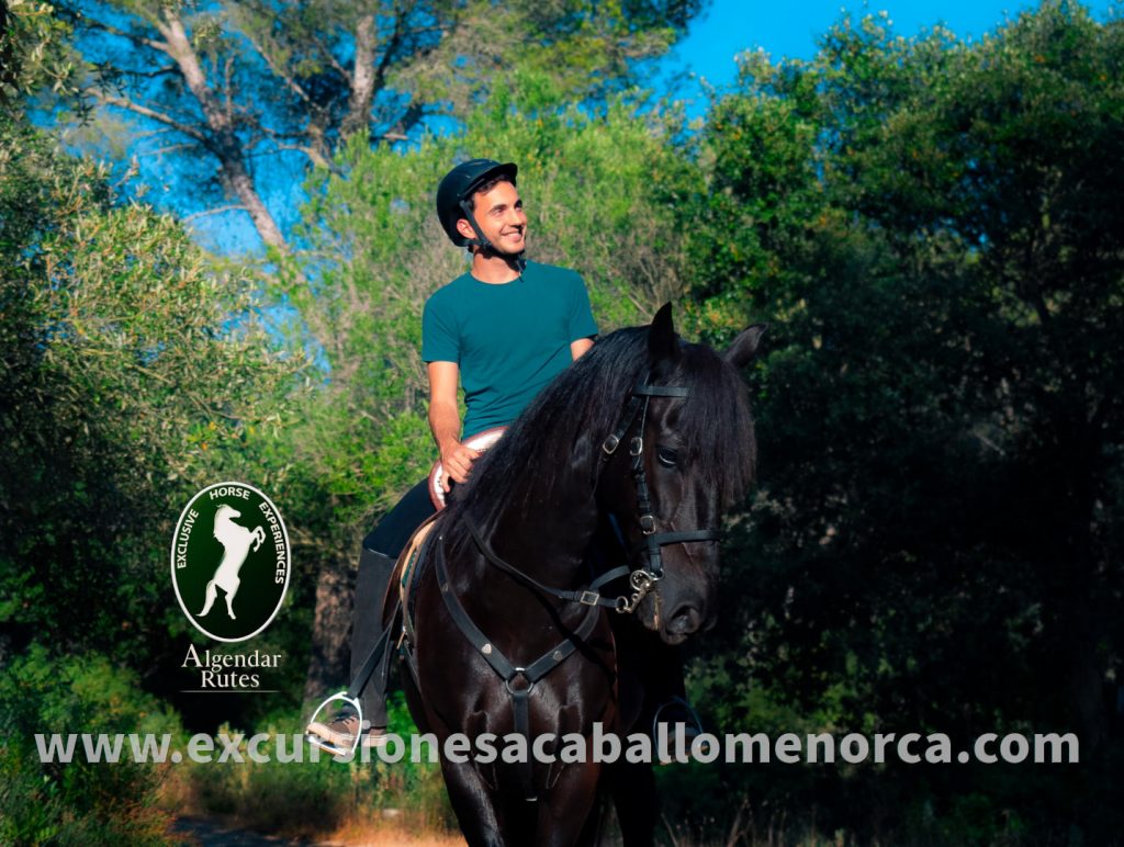
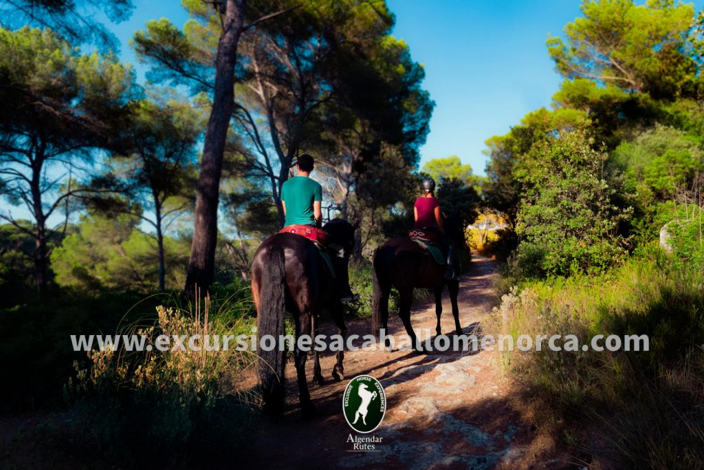
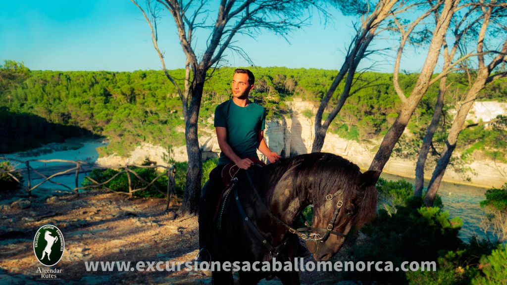
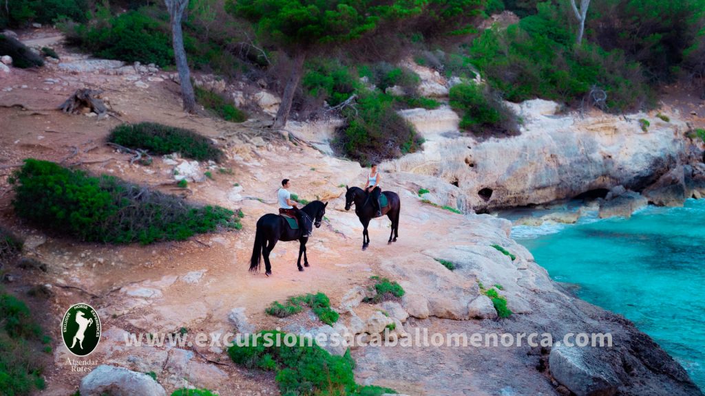
From the point of view of horse riding, the main feature is that it is an easy and safe route. For the most part, it travels roads and trails under the shade of large pine trees and it does not include major difficulties concerning horse management.
Landscaping
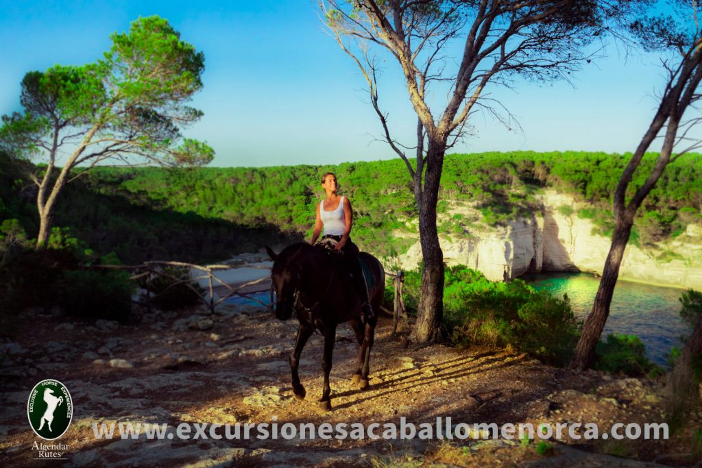
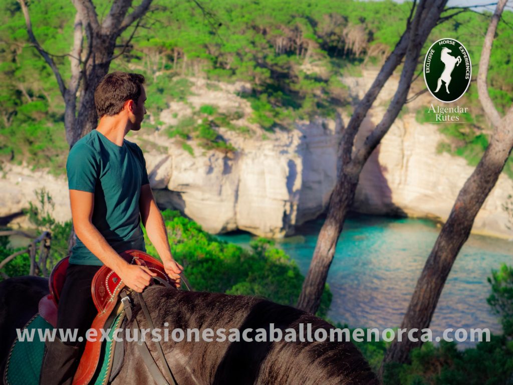
The route stands out for including three viewpoints that from the top of large cliffs, allow you to enjoy some of the most beautiful views of the southern coast of Menorca and the beach of Cala Mitjana.
Nature
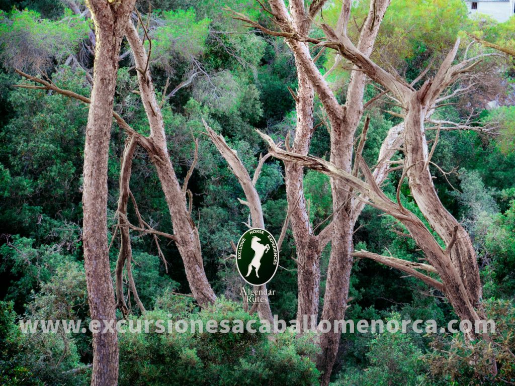
The route runs in the shade of large pine trees in a typical Mediterranean forest with calcareous soil. This is emphasized by the presence of large white pines (Pinus halepensis) and wild olive trees (Olea Europea) in the areas most exposed to the sun. Meanwhile, in the areas with more hours of shade and, therefore more humidity, we can find concentrations of holm oaks (Quercus ilex). The undergrowth is made up of a surprising variety of flora represented by plants such as kills (Pistacia lentiscus), thyme (Thymus vulgaris), reeds (Ampelodesmos mauritanicus) or the white rockrose (Cistus albidus). Finally, it must be highlighted that on the beach itself we find a dune system with flora such as the blot (Ammophila arenaria) or the grass of the sand (Elytricia juncea).
Beach
Cala Mitjana and Cala Mitjaneta are two unspoilt beaches characteristic of the South of Menorca. They stand out for being the end of a ravine, whose origin is in the interior of the island. They have crystal clear waters, white sand and pine trees. By municipal regulation, circulation on the sand and bathing area on horseback is restricted during the months between Easter and October 31st. Therefore, in the months considered as “bathing season”, pets will not be able to go there. If the excursion takes place outside this period, the beach will be accessed.
Ethnology
The Cala Mitjana forest stands out for a succession of ethnological remains that tell us about a bygone era in which many families lived and worked hard in industries located in these places.
The lime kilns. In other times, lime was the mortar, stucco and paint used for construction. The ovens that produced it were located in the middle of the forests since the trunks and branches were the fuel to keep them at 1000 degrees for days.
The quarry. From immemorial time, the construction in Menorca has been based on the calcareous stone block; the “mares”. One of the deepest and most recognized quarries on the island was located in the area of Cala Mitjana.
Coal cellar. Known in Menorca as “sitges” they produced the charcoal necessary for household kitchens.
Along with these elements, workers in those industries built cabins and stables, many of which are still visible.
The last ethnological element to highlight is the artificial temporary puddles. They were chopped into rocky soils served to collect rainwater. This allowed peasants to keep large herds of pigs and sheep in the forest for months without having to procure water for them. For this same purpose you can see a well or a cistern with troughs.
History
History has basically left us with a couple of types of structures currently visible. The most recent are two bunkers that were part of an extensive network of fortifications that had to defend Menorca from a landing during the Spanish Civil War (1936-1939).
The other type of structure is the Bronze Age burial caves known as the “Cova de ses taronges” (Cave of the oranges). The later uses that have been given to them during the 3000 years that separate us from their construction have gradually degraded them and have altered their original appearance as a sepulchre.
Ali’s bridge (“Pont de n’Ali”)
It is a whim of nature consisting of a tunnel sculpted by the waves of the sea in a small ledge of the cliff rocks. Popular culture has explained the phenomenon with a legend about goblins known as “boiets”. Other stories tell of a North African pirate, named Ali, who hid his ship in the tunnel when he landed in the area to get slaves and loot.
In its surroundings you can see a series of piers carved out of the rock whose use was to give way to the sea from the production of lime, blocks of sand, coal and agricultural products in a Menorca very poorly communicated by land. In parallel, these piers allowed the constant entry of contraband material until very recent times.
Geology
The area in question is part of the huge rocky platform that forms the South of Menorca in opposition to the much older and more varied north (rock-wise speaking). The South is an extensive morphological unit of limestone rock formed in a shallow warm sea during an extensive time frame that would be between 11 to 5 million years ago. This calcareous platform would especially have its origin in the shells and spines of underwater animals that were deposited on the seabed when they died, as well as corals. In fact, it is calculated that approximately 80% of this rock is of biological origin. At some points this calcareous platform becomes 500 meters thick.